
After a long hiatus exploring the wilderness, I am glad to be back doing solo exploring the weekend outdoors over the past two weeks.
Two weekends prior, I joined my Sydney choir friends to get a glimpse of what’s left of Aussie autumn foliage season. The Blue Mountains National Park, located west of Sydney, provides stunning vistas of the beautiful autumn foliage. Autumn scenery in places like Blackheath, Leura, and Mount Wilson where we paid a visit, are particularly beautiful.
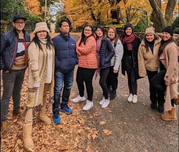
(Photo: Giselle)
My last solo trek was in January from South Turramurra to De Burgh Bridge, a very convenient route within my neighborhood. With more than dozen hiking destinations in my wishlist, an it’s about time to spend winter starting to tick them off one by one. Joy, our fellow Sydney choirmember who was a last-minute dropout in the Mount Wilson trip, advised Karloo Pool track. Realizing that it’s actually in my checklist, her suggestion eliminated the task of figuring out which one in my list should be the next.
This destination is quite an effort to fulfill. Located northeast of Royal National Park, it will take almost two hours by public transport — a bus and two long train transfers. I completed nearby Engadine trail, a 13-kilometer loop in January 2022, just before the unseasonably rainy summer season concluded, dashing hopes of sustained weekly hiking trips to start the year.
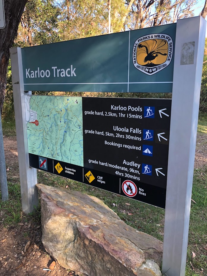
Karloo Track is just close by that, in fact, the trail intersects a portion of Engadine Track, which will make this terrain a bit familiar, characterized by moderate descents and sudden uphill climb (if you take the counter clockwise orientation).
This moderate trek travels from Heathcote train station to the picturesque Uloola Falls in Royal National Park’s north-west area.
This moderately difficult walk winds across heathland, past Karloo Pool, a favorite swimming and picnic spot. You might be tempted to take a little dip before proceeding. Look for the ‘whaleback’ rock outcrops, so named because they resemble whales rising for air. Uloola Turrets’ intriguing rock outcrops are also worth visiting.
I left home soon after 12 p.m. after concluding errands late in the morning and watching an equally important (to me) Diamondbacks game that ended in a dramatic late finish that featured Corbin Carroll’s first grand slam. At 2:30 p.m., I arrived at Heathcote station. While I was aware that sunsets were earlier this time of year, I was confident (in retrospect, cocky was a more accurate adjective) that I would finish it before sundown.
Unlike most of my walks, I carried a salami and cheese sandwich to eat later while ostensibly watching the falls, a half-filled water bottle, and a mobile charger.
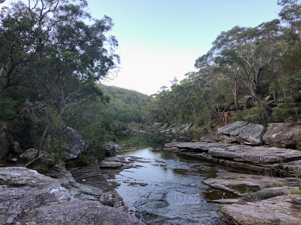
I chose to take the same counterclockwise route, descending to Karloo Track, passing through Karloo Pool and its subsidiary creeks, and then turning left to Engadine Track after a small diversion from Kangaroo Creek’s bank.
It didn’t take long for me to arrive at Karloo Pools, where a group of young people were staying for a swim while others cheered on a friend celebrating his birthday. A father and his little daughter were ahead of me, navigating the track, which was occasionally obstructed by fallen bushes and tree branches, and finding inventive ways to cross, usually by hopping over stones and rocks. While the path was pretty clear in this section, I began to note that progress was impeded by terrain scattered with tree limbs and obviously washed out by floodwaters.
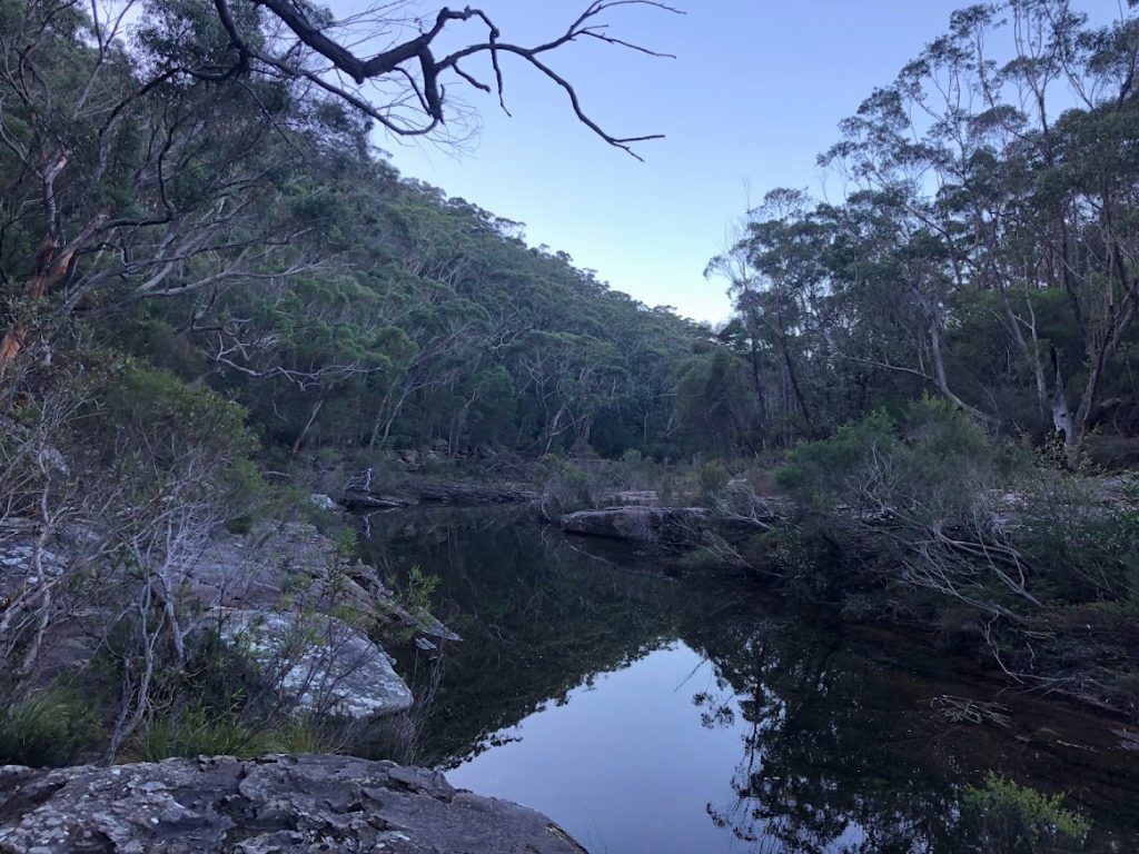
For a brief while, it appeared that I was alone in this section of the park, as the birthday cries had faded and the father-daughter duo had chosen to retrace their tracks. As I hopped from boulder to boulder to bridge the creeks, I remembered Alexander Jurjine, a Soviet physicist who staged a daring escape from Russia to freedom by foot over the Soviet border with Finland in 1979. For a brief period, I pretended to be his daring scheme to outwit border officials by meticulous planning and leaving no trace of activity.
It was nearly 4 p.m., and my app showed I had only traveled four kilometers, an extremely poor pace. However, it is important to exercise caution when navigating terrain that no longer carries the tracks that serve as guides for hikers; crossing the slippery edges of rocks is frequently a balancing act. I took a brief break for a food and to finish up my remaining water supply. The sky was clear, but because the sunlight was only reflected on the treetops atop the hills, I knew I needed to make up ground and hike back up before it got dark.
My attempts to accelerate were foiled on a few of times when I realized I should have crossed the creek 50 meters earlier. I had no alternative than to return, losing valuable time or naively elect to leap into that shallow body of water. (You can see it on the recording at the 7-kilometer mark.) The impediment has grown in size along the road. There are several options for moving forward, but you must select the safest one. I won’t risk fracturing an ankle by raising my pace to make up for lost time if I’m alone.
To save my phone power, I turned off my favorite music playlist. The music had been replaced by a late afternoon cacophony of birds and leaf rustling. It can be unsettling, especially if you’re used to listening to a podcast or conversing to a trekking buddy.
Along the way, I noticed the placement of small yet distinguishable red ribbons tied on tree branches indicating the direction of the path. They are worthy alternatives to the signposts I often see on other trails.
I once had no choice but to cross a portion of the creek, slipping and getting my shoes and jacket soaked. Walking with the extra weight of a wet clothing felt cold, clammy, and uncomfortable.
By this point, I picture having hiking buddies and being chastised for taking the incorrect path or choosing this road in the first place. But I’m alone, calm, and in charge of my pace, with no trace of self-doubt. I guess I followed Alexander’s lead in completing his escape. He’d either succeed or be apprehended and transported to the Gulag. In my case, it’s far less hazardous, but nonetheless exciting.
After touching the sandy shores of Kangaroo Creek, it was time to climb Engadine Trail. Despite the fact that it is 15 minutes before 5 p.m., I am relieved that I do not need to think of novel methods to proceed; the trail is steep but well-defined.
It was dark by the time I arrived to Parklands Trail, and I had to use the flashlight on my watch to guide me. It was around 6 p.m. when I arrived at Heathcote station.
With that, one more trail now belongs to Done and Dusted category.
Lessons learned
- Arrive at the location earlier, and allocate extra time to navigate difficult terrain, and respect the guide when the grade says it’s hard.
- If traveling alone, fill out the Trip Intention Form.
- Get a more powerful power bank.
- Invite people who share the same interest and risk appetite for this types of trails.